
This is the first of a series of bike rides around the Peak District. It starts at Ashbourne and finished at Parsley Hay, at the end of the Tissington Trail
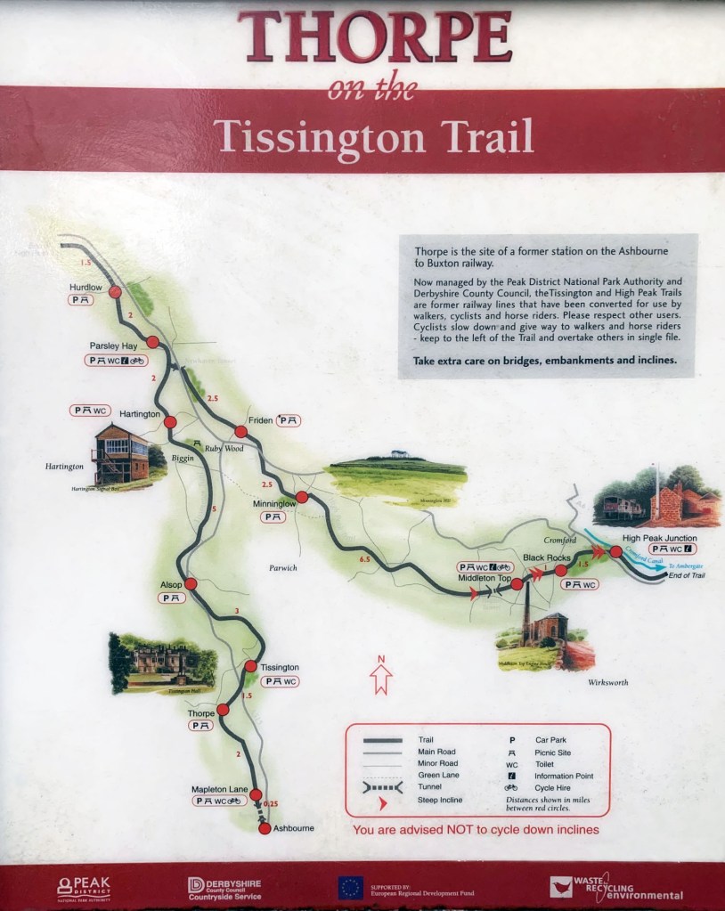
The Tissington Trail is 14 miles long starting in Ashbourne and finishes at Parsley Hay. It connects up with the High Peaks Trail just south of Parsley Hay.
History.
The trail runs on the old Buxton to Ashbourne railway line that originally opened for trains in 1899.
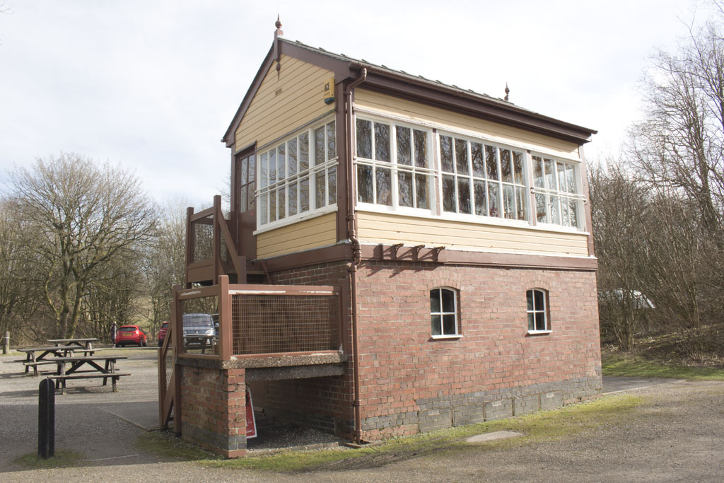
The railway line was closed as part of the Beeching cuts, in 1967. It was acquired by the Peak Park Joint Planning Board in 1968, and they removed the track, platforms and stations. You can still see some of the platforms in places along the trail. The signal box at Hartington Station was spared and is now used as an information centre, and a small café (not always open).
In 1971 the trail officially opened for walkers, cyclists and horse riders.
In 1980 The Seven Arches Viaduct at the Ashbourne end of the trail collapsed during routine maintenance work, there is now a steep decline and incline where the viaduct once stood.
About the Trail
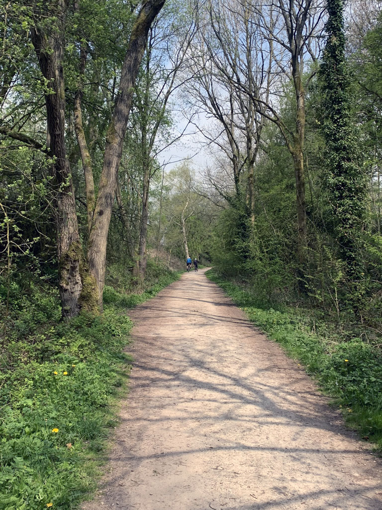
It is a traffic-free route available for walkers, cyclists and horse riders. It is mostly flat with a few small inclines, making it suitable for all ages.
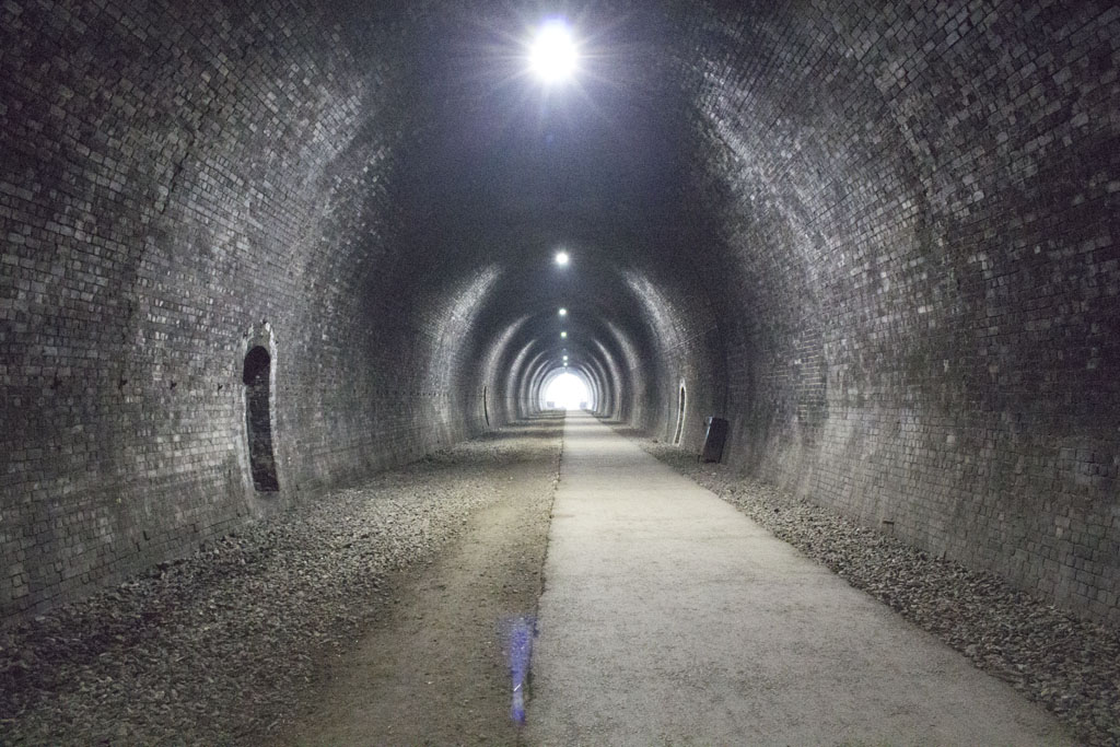
The trail starts in Ashbourne through a 100m tunnel, that leads to a car park with toilets and a bike hire shop. It ends at Parsley Hay, with similar facilities and also a café (see map).
The Trail passes through the Peak District giving wonderful views of the surrounding countryside. Passing through or close by to Dovedale, Thorpe, Hartington, Alsop and of course Tissington. It takes about three hours to walk, and about an hour to cycle the full length.
Detailed guide to the trail.
I always consider the start of the Trail to be the tunnel in Ashbourne, located at the rear of the Tissington Trail car park in Ashbourne, accessed from Leisure Way via Clifton Road. It’s behind the swimming baths. If you are on foot, it is visible and easily accessed from Station Road. The tunnel is about 100m long, and has lights. This exits at the Mapleton Lane Car Park. There is quite a bit of parking here, as there is an overflow, but you do have to pay and display. There are some free car parks at Thorpe if you don’t want to pay. There are some toilets here, and a place to hire bikes.
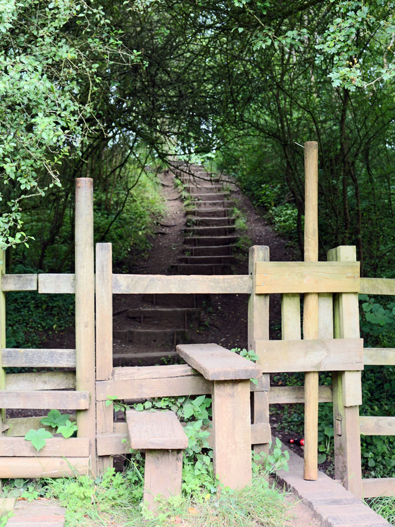
As you head up the trail from here, you get to the site of the old Seven Arches Viaduct, it’s easy to spot as there is a steep slope down to Bentley Brook and another back up again. Just past here there is a public footpath on the left that heads up to Callow Top caravan park via a steep incline with good views from the top, and then down to the village of Mappleton where there is a good pub called the Oakover Arms. There are so many footpaths that cross and start from the trail, it is a good idea to invest in the OS Map of the area.
The first major stopping point on the trail is the site of the long gone Thorpe Station, this is about an hour walk from Ashbourne. There is a free car park here, but little else. If you follow the road away from the trail you will also see another free car park opposite the Old Dog pub, which has recently re-opened. The village of Thorpe is about 500m down the road to the right of the pub. This is a good place to walk to Dovedale from, which is about 30 minutes away on foot.
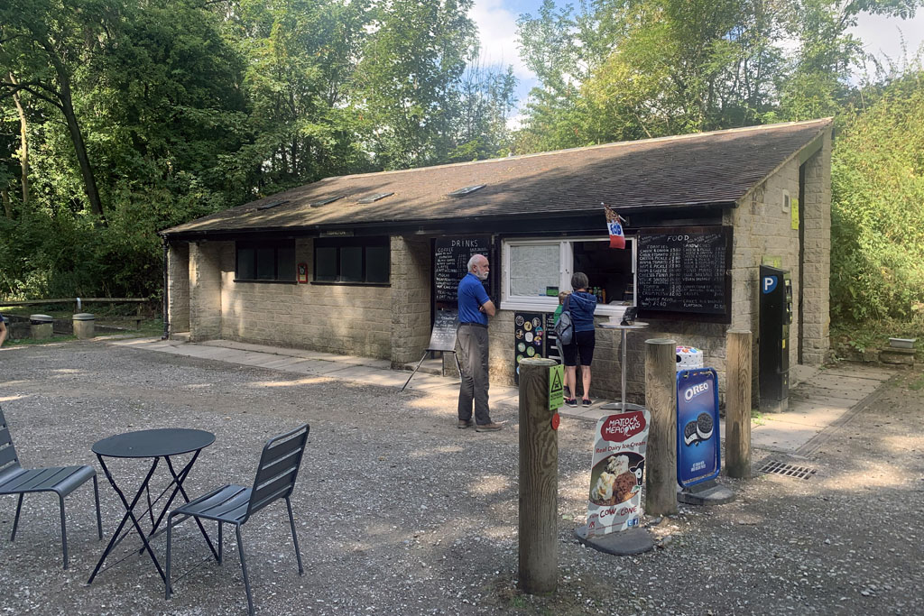
As you carry on up the trail for another mile and a half the next stop is the site of the old Tissington Station. There are some toilets here, and a small take away café. You can park here, but you have to pay and display. If you follow the road away from the car park, it takes you into Tissington itself. A lovely little village, with historic old buildings, pond, St Mary’s church and Tissington Hall. The Hall and gardens are open at certain times of the year, but you will need to check in advance. On Ascension day every year the five wells are dressed in the village. It is well worth a small detour.

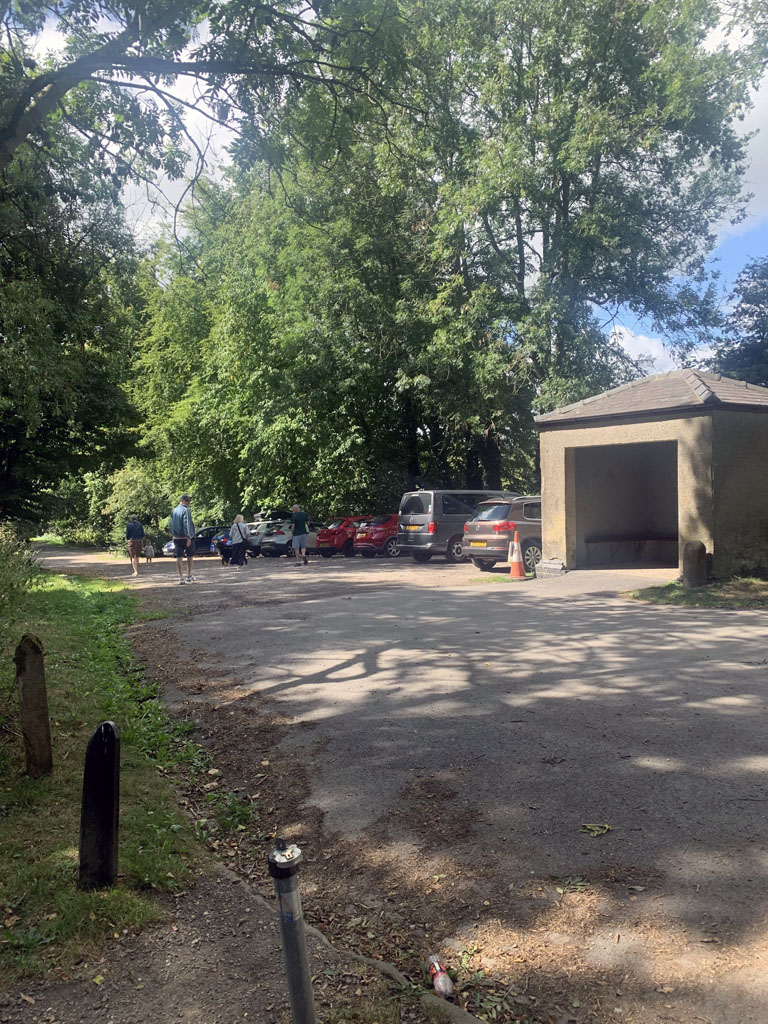
The next stopping point on the trail is the old Alsop en le Dale station a further three miles on. There are no buildings here anymore, but there is a pay and display car park and some picnic tables.
Four miles from Alsop you get to Ruby Wood, a picnic area planted and created in 1991 to commemorate the 40th anniversary of the National Park.

It is another mile from here before you get to another old station at Hartington. There are toilets here, and a pay and display car park. There is also the original signal building, which is now an information centre selling refreshments at busy times (not open very often). The village of Hartington is a small detour from the trail and has plenty to see, including its famous cheese shop.

About a mile further on you get to the junction with the High Peaks Trail. It is possible to link both the Tissington and the High Peak Trail together via Carsington Water for a 30-mile route. I will write a report of this loop at some point, so keep checking back.
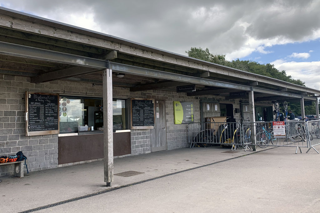
The final stopping point and the end of the trail is two miles further on at Parsley Hay. There are more facilities here, with a take away café, toilets, bike hire and an information office. The carpark is pay and display, but there are a lot of spaces. You can carry on up the High Peak Trail for a further three and a half miles to its conclusion if you want to extend the route.

If you like this bike ride, or have any suggestions, please get in touch, it would be good to hear from you. Also if you would like somewhere to stay in the area, we have a lovely cottage that is available for holidays and short breaks throughout the year. Aldergrove Cottage
We also have a facebook page, search for “letslive holidays”, or click the link below. Please like, share and follow us, it is really appreciated.
https://www.facebook.com/LetsLive-Holidays-103806115442908

